| Hokkaido Sakura Tour | |||||||
| Hilites | Route | Elevation | Hotels | Garmin | |||
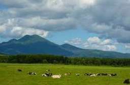
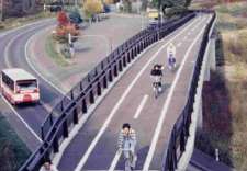
Route #5 from Lake Onuma (32 km), which, although rather busy, is a lovely road lined with Japanese red pines, and has been chosen as one of the top 100 roads in Japan.
The area which stretches from the waterfront, with warehouses of red bricks, to Motomachi, a town on the slope of a hill, is especially scenic.
Popular places to visit are; the Museum of the Northern Peoples, a Trappest Monastery and at the Hakodate City Museum you can see over 370,000 old coins which have been discovered in the Zenigamezawa district. | ||||||||||||||||||||||||||||||||||
|
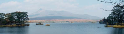
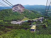
May 19: Onuma - Lake Toya
139km, 230m
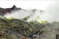
Oshamambe has the Hairy Crab Festival in early June Lake Toya (Toyako) is part of the Shikotsu-Toya National Park. The Toyako region features hot springs and an active volcano, Mount Usu, which last erupted in the year 2000. The Usuzan Gondola (1450 round trip, 6min) goes up to Usuzan Sancho on Mount Usu offering views of Mount Showa Shinzan and Lake Toya. The Usu Crater Basin Observation Deck is on the left after about a 7-minute walk. Passing by the summit (O-Usu), the second summit (Ko-Usu), and the newest peak (Usu Shinzan) on the way to the Gin�numa Great Crater. The Toyako nightly fireworks display runs from Apr 28th to Oct 31st (subject to weather). For about 20mins each evening starting
at 8:45, fireworks light up the evening skies. The fireworks are launched from a moving boat, so they can be seen from all around the lake. | ||||||||||||||||||||||||||||||||||
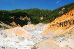
May 20: Lake Toya - Lake Shikotsu
118km, 830m
It is a tough climb through Orofure Pass with an altitude of 940m but there is much less traffic and beautiful forest scenery. After your hard work, you can look forward to a hot spring in Noboribetsu.
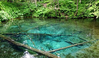
Make the extra effort to visit Oyunuma Pond where there is a good nature trail. Lake Kuttara is another sightseeing spot. A quiet, narrow road, which is impassable to the big sightseeing buses, will take you to the heart of Hokkaido's natural beauty. 141 will take you directly to the Lake Shikotsu. The width of this road is only about 1.5 lanes, so be careful riding along this narrow road. Drivers in Hokkaido do not always expect cyclists in this area. Follow a trail up to Mount Tarumae famous for its huge lava dome. Mount Tarumae is still an active volcano and access to this lava dome is forbidden. The stark mountain scenery denuded of trees is an eerie but impressive sight.
| ||||||||||||||||||||||||||||||||||
|
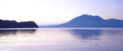
May 21: Lake Shikotsu - Yubari 116km, 31m
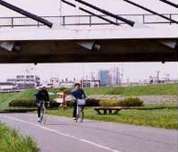
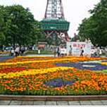
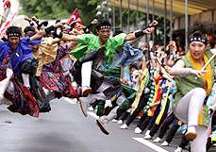
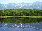
Lake Shikotsu is the northern-most ice-free lake and amongst the clearest lakes in Japan. Lake Shikotsu is 400 m deep and so is known as the bottomless lake. Branches sticking out its glass-clear surface, looking eerily like bones. (The meaning of Shikotsu in the Ainu language is a big hollow or a valley) Hwy 453 follows the north shore of Lake Shikotsu. The Shikotsu Cycling Road starts as soon as road leaves the shoreline. After 5.7km there is a turnoff to Hwy 78. This goes to Lake Okotanpe (2.6km, 130m detour), on of only three Ecosystem Reserves in Hokkaido. It has limited access and is rarely visited. The Shikotsu Cycling Road continues along 453 and Toyohira river for 41km right into downtown Sapporo The main venue for the Sapporo Lilac Festival, May 19 - 23, 2011, is Odori Park. The Yosakoi Soran Festival, Wed June 8 - Sun Jun 12, 2011 Daily schedule here - scroll to page 4. The dynamic dance festival in which over 300 teams from throughout Japan and over 30,000 people dance to the intense rhythm. Odori Park, etc
Follow the Shiroishi Cycling Road out of Sapporo for 19km. Turn off at Kitahiroshima and head towards Yubari.
| ||||||||||||||||||||||||||||||||||
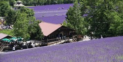
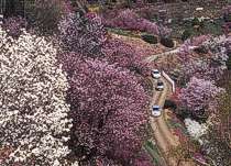
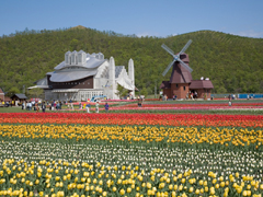
Although the Farm Tomita is very famous for lavender, we think most people will find Saika-no-sato, 1km west of the Naka-Furano station, more impressive.
| ||||||||||||||||||||||||||||||||||
|
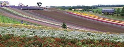
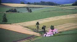
Furano city is famous for its lavender gardens and farms and is always crowded with tourists. The scenery of the area from Kami-Furano to Biei is very beautiful. You will enjoy the dramatic farming landscape and you can just crank-away as you like without having to check the map. There is a famous photo gallery, Takushinkan of Shinzou Maeda in Biei. Unlike other cities in Japan, all the power lines are laid underground. The best views in Biei are atop the surrounding hills which can be accessed by some narrow local roads , such as the "Roller Coaster Road". When you get up to the hill called "Patch Work Hill", you will have many great photo opportunities. Asahikawa, the second largest city in Hokkaido, is nearby but rather uninteresting. A cycling path travels for 40 km from Asahikawa towards Sounkyo.
For the remaining 30km to Sounkyo the bike path runs next to the highway.
| ||||||||||||||||||||||||||||||||||
|
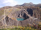
May 24: Sounkyo - Kitami
101km, 415m Sounkyo gorge follows the upper portion of Ishikari River, and is about 24 km long. It is the most popular spot in the Daisetuzan area with many cliffs, rocks and waterfalls. In the center of the area is the Sounkyo hot spring resort.
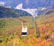
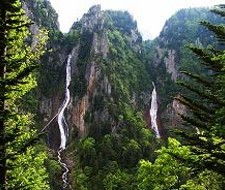
Mount Kurodake, 1,984 meters, is one of the volcanoes of Daisetsuzan and located 5 km southwest of Sounkyo resort. The Kurodake ropeway, (�1750 round trip, 1.6km, 7 min), leaves from the Sounkyo Onsen and goes up to the 1,300m high observatory with the ropeway. A chair lift (�600 round trip, 15 min.) from there goes to Mt Kurodake and it is an hour hike to the top. Ryusei (meteor) & Ginga (galaxy) waterfalls are located about 3 km east of Sounkyo hot spring resort. Oobako is located 7 km east-southeast of the Sounkyo hot spring resort. Huge cliffs stand in front of you. This is the most famous spot in Sounkyo. There is similar "Kobako" near here, but it is closed to traffic due to a rockfall hazard.
The Kitami Flower Paradise is panoramic flower garden designed by famous biologist Yoichi Azuma. This massive 28 hectare
mountain is filled with 30,000 flowers of 85 different kinds. See Chinese cherry blossoms in May, peonies in June, Japanese roses in July, bulbaceous flowers in August and
chrysanthemums in September.
| ||||||||||||||||||||||||||||||||||
|
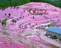
Nonky Land Moss Pink Festival, Higashimokoto, Ozora-cho (Mokotoyama-Onsen, Shibazakura Park) From Early May to early June pink and white moss flowers cover the slopes. Helicopter rides available.
| ||||||||||||||||||||||||||||||||||
|
May 26: Teshikaga - Rausu
116km, 161m
Rausu Kunashiri Observatory is located 5 km west of Rausu town and is on the hillside. From here we can see Rausu town and Kunashiri island. Luminous moss grows wild in Makkausu Cave, located 1.5 km northeast of Rausu town. This is their largest habitat in Japan' The best time to see the moss is while the sun is shining in the summertime The Rausu Hot Spring is free and just north of the town. The Rausu Geyser flows every 60-90 minutes for 5-7s and is up to 13m high. It's only one minute from the entrance of Mt. Rausu, or five minutes from the Rausu hot spring on foot. Whale, dolphin and bird watching starts in May, ends in mid-August | ||||||||||||||||||||||||||||||||||
|
May 27: Rausu - Abashiri
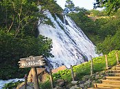
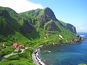
123km, 772m Shiretoko Pass is between Utoro and Rausu town and is one of the most beautiful passes in Hokkaido. It is located at the level of about 740 meters next to Mount Rause (1660m) the highest mountain on the Shiretoko peninsula. Utoro is the main town in Shiretoko and is also a hot spring resort. The sightseeing ship to Cape Shiretoko leaves from here. Oronko-iwa is a huge rocky hill near Utoro port. It is 60 meters high, and you can climb to the top. Yuhidai is a nice spot for viewing the sunset, and is located in the camp site at the east end of Utoro town. Cape Puyuni is a scenic overlook located 3 km northeast of Utoro. It is at the side of the road, and we can see the Utoro town and the sunset over Okhotsk Sea. Real cape is located about 1 km north of this point. Furepe Waterfall is near here.
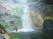
Shiretoko-goko lakes are located 10 km northeast of Utoro. There are 5 small lakes in the primary forest. There is a walking trail passing through all lakes, and we can also select the route passing through only the First and Second lakes. It takes about an hour to visit all lakes, and about half an hour to visit only two lakes. When brown bears appear the trail is closed. The Kamuiwakka Falls are one of Japan's more amazing natural wonders, and the Ainu name means "river of the gods". The road to the falls is closed to private traffic (including bicycles and hikers). The shuttle bus (�1180) from the Shiretoko Shizen Center goes 11 km up a bumpy dirt road, (43 min. one way, stops for 10min, every 40min). At the end of the track. The 30 min. climb up the river in water that gets gradually warmer as you ascend, and the rocks more slippery from the algae. At the end the waterfalls cascade into a free natural hot spring pool large enough for half a dozen people. Only the very first part of the river up from the bus terminal at the road bridge was open to the public because of falling rocks. Cape Shiretoko is at the tip of the peninsula. The cape is a nature preserve, and tourists cannot enter. You can only see this cape from sea on the sightseeing boats. Tours range from 1:10 to 3 hours. Oshinkoshin Waterfall is located about 5 km southwest of Utoro, and is near the coast. Koshimizu wild (aka Primeval) flower gardens are situated on an 8km long sand dune that is bordered by the Sea of Okhotsk on one side and Lake Tofutsu on the other. The blooming of the Chocolate Lily announces the arrival of the short Okhotsk summer, as the clusters of the Japanese bush clover and iris gradually spread across the gardens. The people at the Abashiri Brewery have found a use for the icebergs that wash up on Japan�s cost every year. They�ve melted them and used the water to make the world�s first blue beer. The unusual draft looks amazing and is said to taste pretty good as well. Japanese blue beer also contains a fair amount of seaweed. Abashiri�s green beer is also made of seaweed, as well as hops and a mixture of plants from Japan�s Shiretoko peninsula. The red beer contains anthocyans, natural pigments found in plants and fruit. | ||||||||||||||||||||||||||||||||||
|
May 28: Abashiri - Monbetsu
111km, 45m
The Okhotsk Cycling Road starts in Abashiri and extends for 40km to Tokoro. It is built on an abandoned railway and has it's own bridges and tunnels.
| ||||||||||||||||||||||||||||||||||
|
May 29: Monbetsu - Hamatonbetsu
128km, 72m
| ||||||||||||||||||||||||||||||||||
|
May 30: Hamatonbetsu - Wakkanai
94km, 62m Lake Kucharo near Hamatonbetsu Town is a designated wetland under the Ramsar Wetlands Convention. North from Lake Kucharo is a bleak but beautiful coastline.
About 30 kilometers from Lake Kucharo you will come to Sarufutsu Michinoeki (Roadside Station) where you can see things that commemorate the 745 victims of the sinking of the USSR ship the Indigirka. During a blizzard in December 1939 the Indigirka was stranded on a reef 1.4 kilometers offshore of Sarufutsu Village. The ship then capsized and local people helped rescue over 400 people facing certain death. Thus for a long time it had been believed to be a touching tale. But after Soviet breakup, it was revealed what actually took place. Guards fired on prisoners trying to evacuate, keeping them in the holds. When the ship capsized they were sealed below decks. It then took 3 days to begin rescue of the prisoners. A hole had to be cut in the side of the ship to free them, 741 were dead, only 28 survived. The captain was later convicted of negligence and executed.
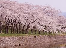
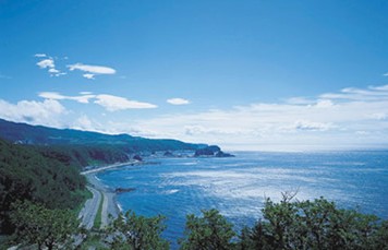
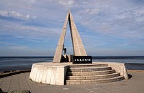
The area past Higashiura is uninhabited. You will reach Cape Soya, the northern-most point in Japan. The southern hill of Cape Soya has the memorial for the shooting-down of a KAL airliner in 1983 by the Soviet airforces and right next to it is the World Peace Bell made from coins from many countries. Biking north along the coast there are dozens of small seaweed drying family operations. Wakkanai Park is a large park spreading over the grassy hills west of the town, offering some commanding views over the area. A short rope-way ascends the hill, claimed to be the shortest in the world; the two gondolas leave every 10 minutes through the day and cost �180. Over 4000 wild cherry trees grow in the park if you are here during Hanami (mid-May). To get an even better view you can ascend the 70 meter high Motoe Hiraku Centennial Memorial Tower Open 9:00-17:00 for a 360 degree panoramic view of the cape, the expansive Sarobetsu Plain, the Rishiri Volcano and even sometimes to Sakhalin in Russia. The Meguma Wilderness Garden near the airport has 300 different flowers which bloom in spring. The Breakwater Dome (North Wharf, 5 mins from the station north along the harbour). Built in the 1930s, this odd-looking breakwater is a 427 meter arched hallway supported by 70 Roman style pillars. It rises over 13 meters up in the air to provide some protection for the strong winds in the area. It looks entirely out of place About 300 seals have decided that the concrete boulders of the small fishing port of Bakkai is a good home Lake Onuma, a small lake east of the city, is a migratory stop for the Tundra Swan on their way to or from Siberia, sometimes numbering tens of thousands. There is a Swan Festival held here in May. Other species that can be observed here include Herons and White-fronted Geese At the northern tip a nice lighthouse and an excellent aquarium await you - with great views of Government radars on green hills | ||||||||||||||||||||||||||||||||||
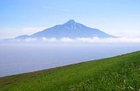
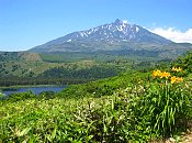
May 31: Rishiri or Rebun Island Cycling roads are well developed on Rishiri Island, but only 25km. Trekking up the island's mountains is more popular. Mt. Rishiri is 1,721m and sometimes it snows even in September. Prepare for the cold and set aside enough time to make the trek leisurely. Ferry 1:40hrs, �2280 +�1390 for bike Rebun Island (Rebunto) is less travelled but is famous for its alpine flowers and is highly recommended. The eastern coast has a good trekking course called Hachijikan Kousu that takes 8 hours. Mt Rebun is 490m high. Ferry 2hrs, �2500 +�1390 for bike
| ||||||||||||||||||||||||||||||||||